Practise-based Research
Reconstructing Chamanga
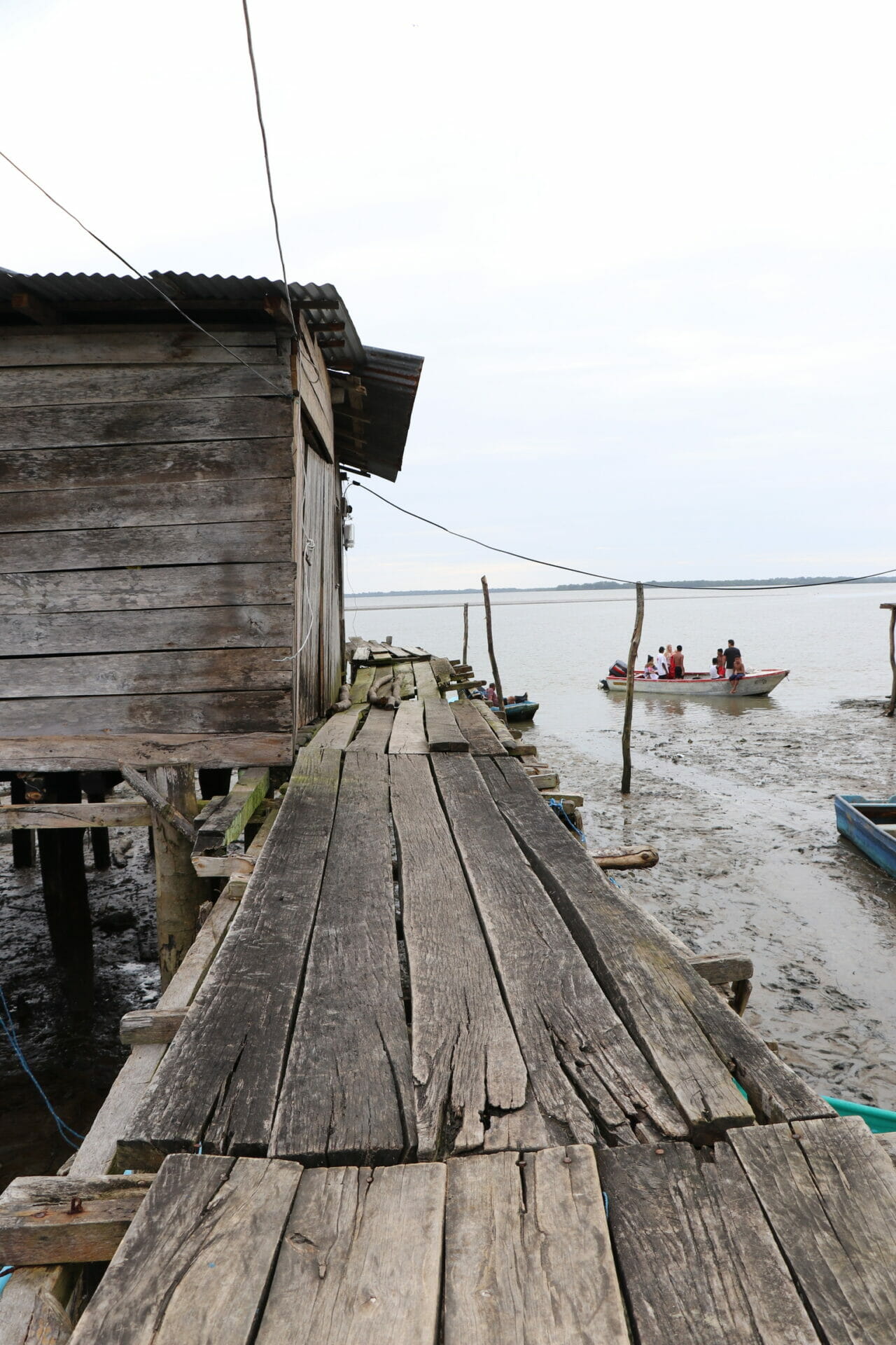
Fieldwork, San José de Chamanga
Project Description
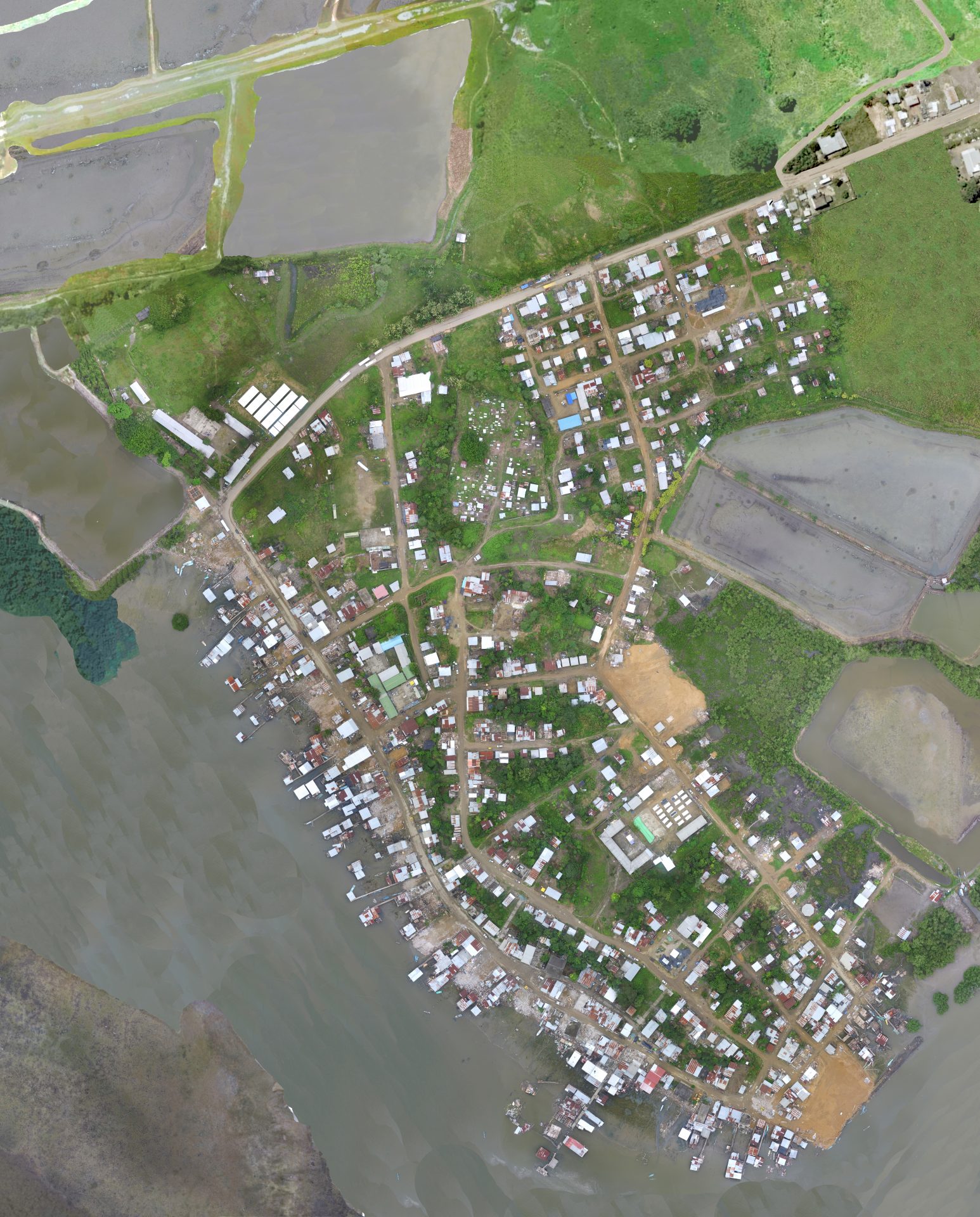
In 2016, the fishing hamlet of San José de Chamanga (Esmeraldas, Ecuador) experienced widespread damages to its ecological, built and social environments, after a 7.8 magnitude coastal earthquake. With the lives of diverse communities greatly challenged amidst pre-existing social and infrastructural adversity, we were privileged to contribute to a design-led reconstruction proposal for the town.
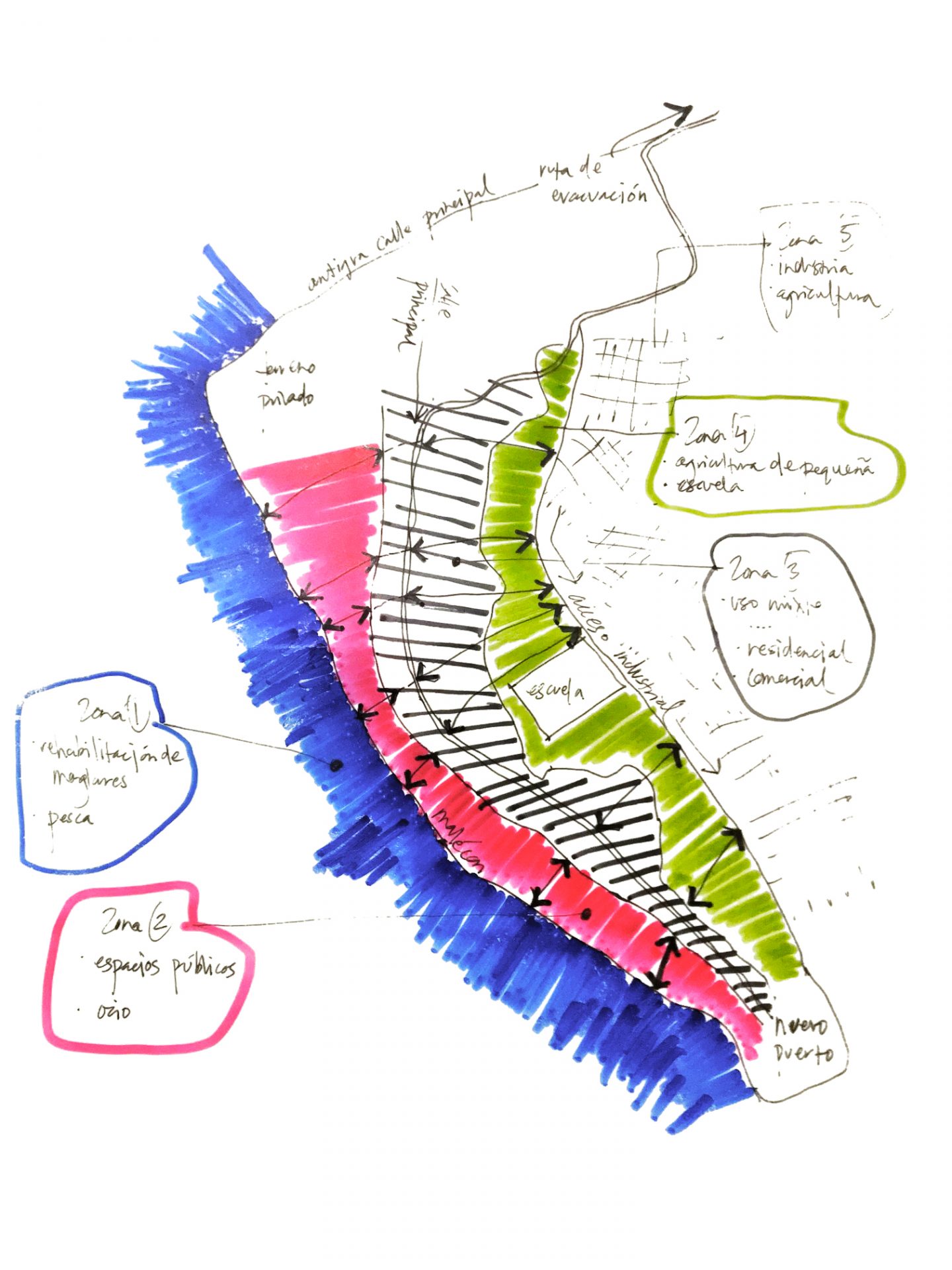
Developed around the flood resilience concept of ‘retreat, adapt, fortify’, the geographic site we focussed on was colloquially known as the calle principal, a long unsealed street in the higher plains of Chamanga, where people resided or ran small businesses. We observed what was organically occurring during residents’ formal and informal navigation through the calle principal, down to the lower coastal plains and malécon (main coastal street). This was coupled by anecdotes from local residents about their shifted sense of place and movement; conversations that were generously shared with us, that inevitably shifted our objective external gaze. Our proposal aims to offer a speculative design response to future seismic activity and other climate risks to the area, in consideration of the socio-cultural and place-based issues that were further destabilised, after the earthquake.
We speculated on how we might sensitively resettle seventy-seven families living along the malécon, as well as several families in risk areas along the calle principal. Inhabited areas that were appropriate to be built up but precariously positioned were ‘fortified’. Families dwelling in areas prone to soil liquefaction, flooding or rising sea levels and tide surge were ‘retreated’ to safe dwelling zones. The lower plains then became ‘adaptable’ zones that were landscaped and terraced for public use, including recreation, fishing subsistence economies and small scale agriculture. During periods of heavy rain these adaptable zones could be flooded without immense loss of property or life. During non-rainy periods they are then reactivated by the above described uses.
Completion Date
2018
Location / Country
Esmeraldas, Ecuador
Project Team
Nikhila Madabhushi
Berenice Diaz
Lama El Saudi
Begoña Peiró
Javier Quiñoá
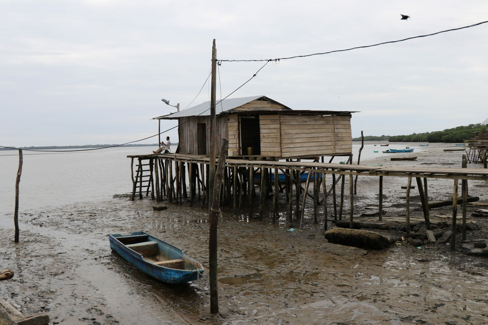
Coastal vernacular fishing huts, San José de Chamanga
We sought to speculate on how we might sensitively resettle seventy-seven families living along the malécon, as well as several families in risk areas along the calle principal. Inhabited areas that were appropriate to be built up but precariously positioned were ‘fortified’. Families dwelling in areas prone to soil liquefaction, flooding or rising sea levels and tide surge were ‘retreated’ to safe dwelling zones. The lower plains then became ‘adaptable’ zones that were landscaped and terraced for public use, including recreation, fishing subsistence economies and small scale agriculture. During periods of heavy rain these adaptable zones could be flooded without immense loss of property or life. During non-rainy periods they are then reactivated by the above described uses.
This method of “urban weaving” seeks to follow the organic pattern of land use that was slowly developing in the lower plains of Chamanga prior to the earthquake. This approach was distinct from the gated “community” typology of the “Ciudadela”—the government housing response after the earthquake, located in the higher plain outer areas of Chamanga. Some people’s living experiences in this new environment suggested that the introduced housing density aggravated pre-existing issues around drug and alcohol abuse as well as domestic violence, due to the social isolation experienced by many people as a result of its physical detachment from Chamanga town.
This work was carried out in partnership between post-graduate students from RMIT and UIC Barcelona. It contributed to ongoing design-led research directed at long-term recovery and development of disaster readiness for Chamanga.
Coastal vernacular fishing huts, San José de Chamanga